NWP_TEAM2
URBAN HEAT ISLAND
Research 2 - Location
Cropland
25
Urban
50
Cropland
25
Water bodies
25
Urban
50
Water bodies
25
Mixed Forest
25
Urban
50
Mixed Forest
25
Research 2 shows three types of land cover when the city is centrally located. Under the same conditions, we analyze the differences in variables based on the type of land cover.
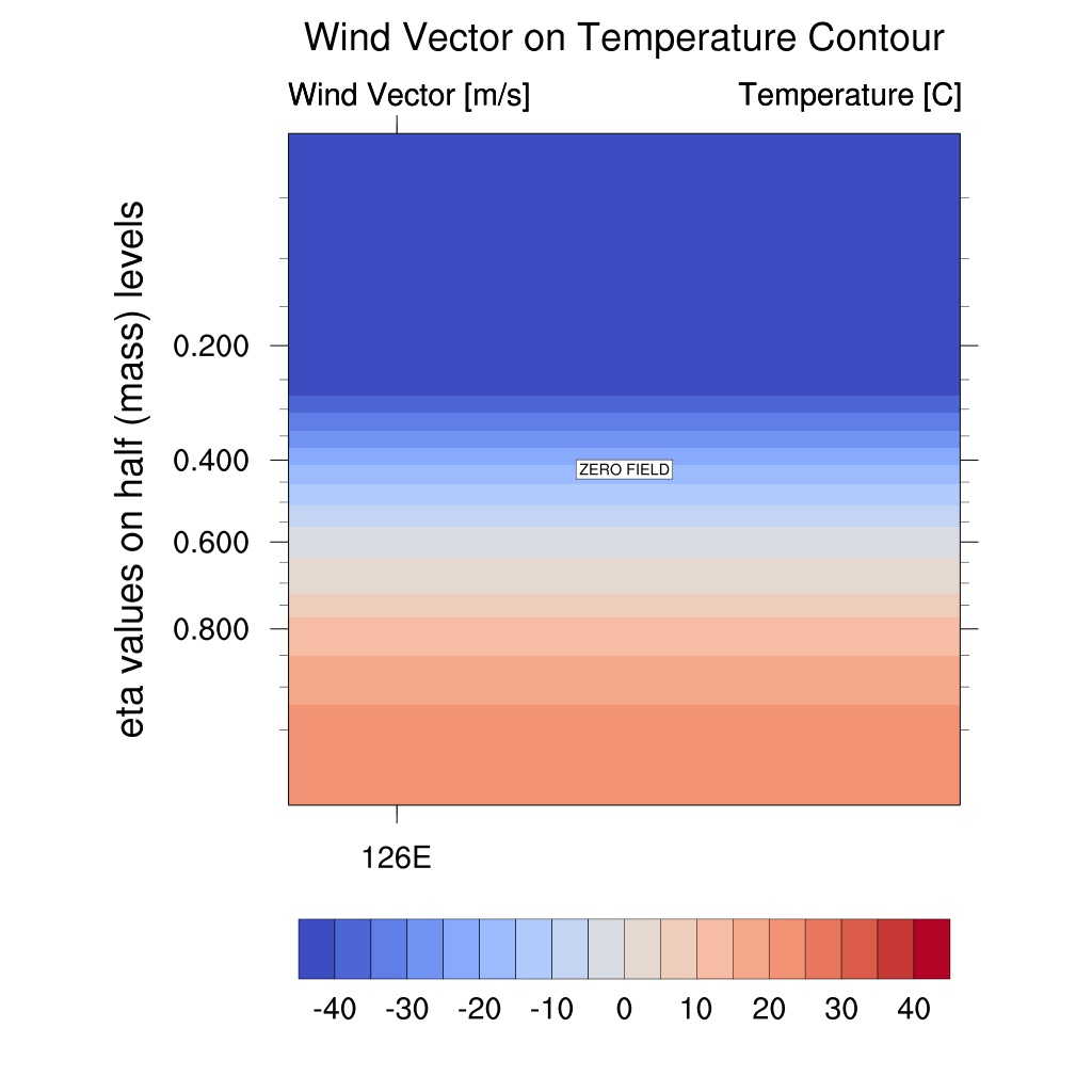
Temperature and Wind Vector


Cropland-Urban-Cropland
Water bodies-Urban-Water bodies
Mixed forest-Urban-Mixed forest
The temperature increases and then, over time, the temperature in the Outer and Urban regions begins to decrease.
-
Cropland : The temperature rises to a higher altitude in the Urban area, but temperatures decrease faster near the surface than in cropland areas. The wind vector converges to the Urban region and then diverges with decreasing temperature.
-
Water Bodies : Only the temperature in the Urban region rises and then falls sharply. The difference between the Urban and Outer regions of this model is the greatest. The wind vector converges to the Urban region and then gradually weakens and diverges weakly. In the evening, there is little wind.
-
Mixed Forest : Temperatures rise to higher altitudes in urban areas, but near the ground, temperatures decrease faster in urban areas than in mixed forest areas. The temperature is lower than that of the cropland model.
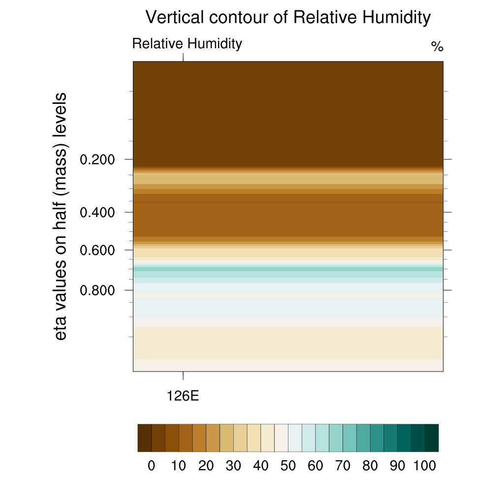
Relative Humidity


Cropland-Urban-Cropland
Water bodies-Urban-Water bodies
Mixed forest-Urban-Mixed forest
Relative humidity near the surface is lower in the Urban area than in the Outer area.
-
Cropland : The relative humidity is lower in the Urban area up to a higher altitude than in the surrounding area.
-
Water Bodies : The relative humidity is the highest. In the afternoon, the relative humidity in the Urban area increases due to the difference in specific heat. After that, the wet air around the Urban area goes out toward the water bodies area as time passes.
-
Mixed Forest : It shows a pattern similar to cropland, but the relative humidity near the surface increases more.
U-wind

Cropland-Urban-Cropland
Water bodies-Urban-Water bodies

Mixed forest-Urban-Mixed forest
The u-wind is directed from the outer area to the Urban area. The intensity of the wind blowing from the outer area to the Urban area is greater than the intensity of the wind blowing in the opposite direction. Over time, it is directed from the Urban area to the Outer area.
-
Cropland : It blows from the cropland area to the Urban area and then from the Urban area to the cropland area. In the evening, it takes the form of a wind blowing from the cropland area to the Urban area near the surface again. The strength of the converging wind is greater than that of the mixed forest.
-
Water Bodies : The intensity is the greatest. It blows from the Waterbodies area to the Urban area and then from the Urban area to the water bodies area.
-
Mixed Forest : It shows a similar shape to cropland. The intensity of the diverging wind is greater.
W-wind


Cropland-Urban-Cropland
Water bodies-Urban-Water bodies

Mixed forest-Urban-Mixed forest
The strong updrafts appear in the Urban region, followed by weak descending currents in the afternoon. In the evening, the w-wind approaches zero, weakening convection.
-
Cropland : Convection is weaker than mixed forest.
-
Water Bodies : The updraft weakens first.
-
Mixed Forest : The w-winds of relatively uniform intensity are split in Urban and mixed forest.